
In the first of these two articles, I showed examples of paintings which are maps, or included maps, charts or globes. These culminated in several of Vermeer’s paintings and their highly detailed depictions of what were fashionable domestic decorations of the time. No artist since has shown the same fascination for putting maps into their paintings.
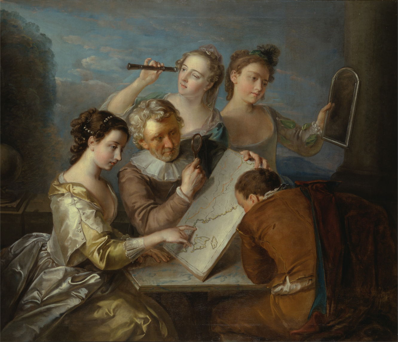
The vogue for series of paintings showing the five senses also died, although Philip Mercier’s The Sense of Sight from 1744-47 is an exception in which two charts are prominent. One of the man’s daughters is tracing with her finger on a chart of what appears to be the eastern coastline of North America, and the son is looking intently at the other map underneath.
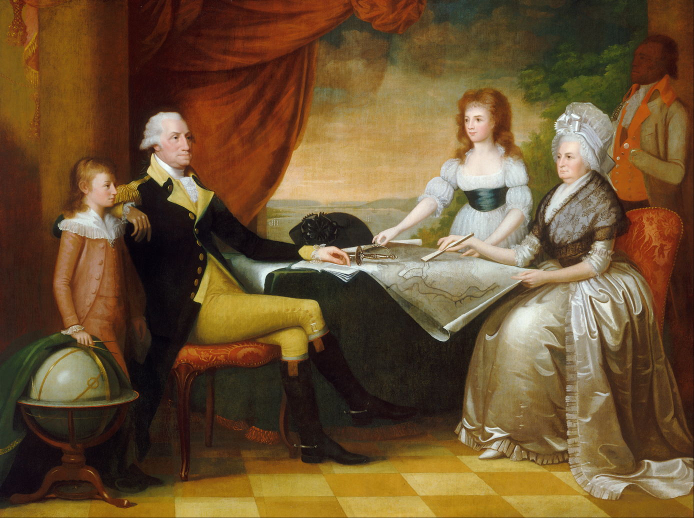
Edward Savage’s portrait of The Washington Family painted between 1789-96 shows the President and his wife, who modelled for the artist during the winter of 1789-90, and two of her orphaned grandchildren. They are gathered round maps of the nation’s new capital named in honour of the President. The First Lady is pointing with her fan to a location which the artist described as “the grand avenue”, which probably represents what is now the National Mall, rather than Pennsylvania Avenue. At the left is a globe, which lacks any locational markings.
In the nineteenth century, maps were included in paintings as part of their narrative.

In Paul-Jacques-Aimé Baudry’s The Assassination of Marat, Charlotte Corday from 1860, Corday stands in front of a map of France which is placed on the wall opposite Marat in his medicinal bath, presumably so that he could remind himself of the locations of all the regions in the nation’s provinces.

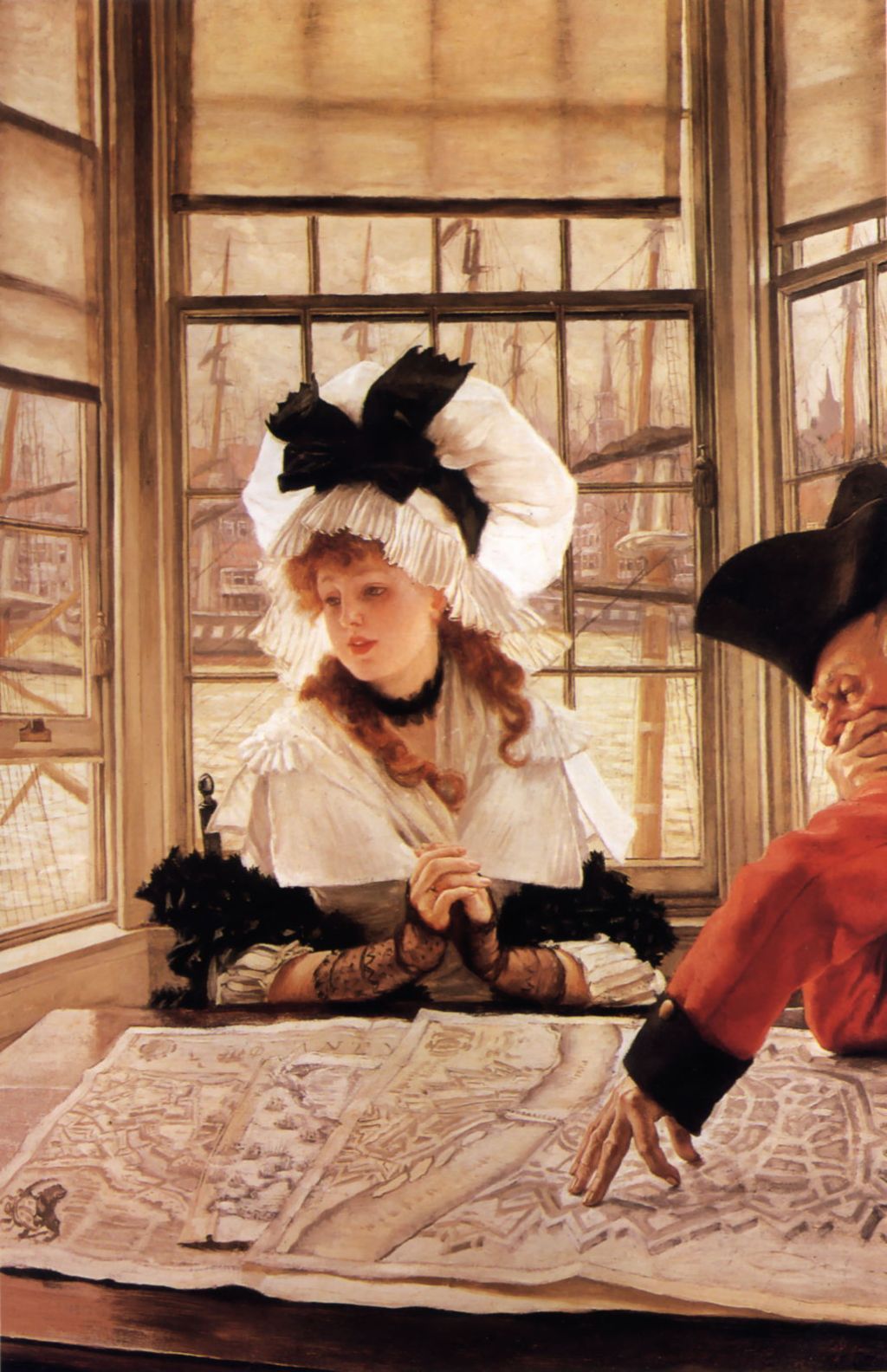
In about 1872, James Tissot embarked on a series of paintings and engravings which were set in a tavern on the bank of the River Thames in London, probably in Rotherhithe or Wapping. The first of those to be exhibited was his An Interesting Story (c 1872), which set the pattern. It is the late 1700s, and an old soldier is telling one or more pretty young women interminable and incomprehensible stories about his military career, with the aid of charts spread out on the table. Here, the story is presumably dubbed ‘interesting’ with tongue in cheek.

In its companion The Tedious Story (c 1872), there can be no doubt that Tissot’s young woman has drifted off into a world of her own, one which is far away from the veteran’s charts.
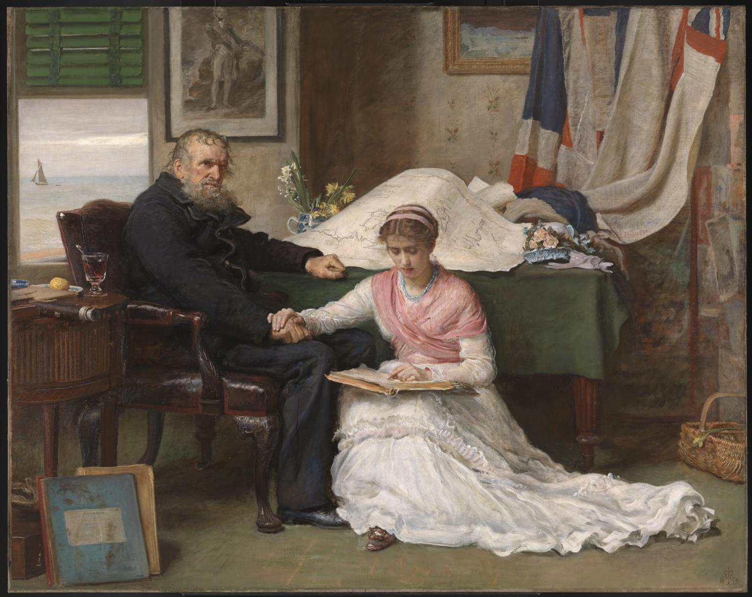
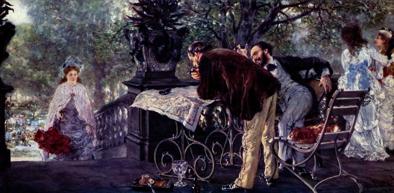
The title of John Everett Millais’ The North-West Passage from 1874 tells you how closely it coincided with the departure of a British expedition in futile quest of the rumoured north-west passage round the north of Canada to the Pacific. Enterprises like that had brought a succession of failures since the famous total loss of Sir John Franklin’s expedition of 1845.
The old man is clearly an experienced mariner, who knows the risks and futility, which are well-expressed in his body-language. The young woman, probably his daughter, is presumably the wife of one of those on the expedition. The man stares hard and cold, the woman reads anxiously. Behind them a chart shows the limited knowledge of the area of the north-west passage at the time.
Adolph Menzel’s Travel Plans from 1875 shows two men discussing where they should go on holiday, in the light of the possibilities revealed by their map. One of relatively few narrative Impressionist paintings, the concept of relatively ordinary people planning a holiday with the aid of a map for tourists was thoroughly modern.
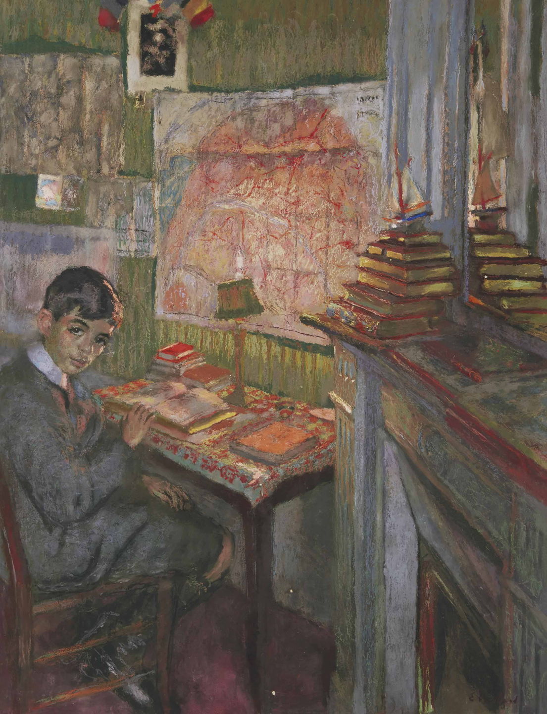
Édouard Vuillard’s Portrait of Jacques Laroche, at his Workdesk from 1916 places a large map of Paris behind this lugubrious young student and his piles of books. This is presumably used to add location to a scene which otherwise could be in any part of the country.
I finish with two near-contemporary examples.

Serhiy Kolyada includes a relatively modern projection of a map of the world in The Theory of Origins (2012), where the map has a specific meaning. The artist explains:
A painting monkey perhaps a commentary of contemporary art? Protective of its bottle of Teacher’s whisky and looking over its shoulder at a naked Teacher pointing to the supposed “cradle-of-civilization” Africa on a world map; both Teachers providing pupils with an escape? Or knowledge? An Egyptian pyramid, Stonehenge, Mount Kailish, the Temple of Tibet, a UFO and dinosaur, Sator Arepo and yin-&-yang all tease but fail to appease. Puzzles, a Bible, equations and runes add to the confusion, offering no real explanation except to say: Maybe Origin Theories are a mess and human beings have no idea, in fact, of their origins on this planet.

We here come full circle, to Philip Firsov’s ink drawing of Dante’s Purgatory from 2015, which is the contemporary equivalent of Botticelli’s Map of Hell from over five centuries before.
