

As cities grew during the nineteenth century, what had been countryside in and around them was swallowed up by housing and factories. In the first couple of decades, livestock grazed and cows were milked within a couple of miles of the centre of London.

The American history painter Benjamin West painted this view of Milkmaids in St. James’s Park, Westminster Abbey beyond in about 1801. Two cows and attendant milkmaids are providing a supply of fresh milk for the crowds in this royal park with Buckingham Palace on its edge. This remains 57 acres (23 hectares) of grass, trees and lakes.

John Linnell’s Evening, Bayswater from 1818, only two centuries ago, shows what was then a rural part of London, out to the west of what’s now Paddington Station, in more peaceful times before this area was assimilated into the growing city. Although it has retained some garden squares, this became a densely populated area during the nineteenth century.

Kensington Gardens: Vicinity of the Pond, painted by Paul Fordyce Maitland in about 1907, shows the Oval Pond in the middle of these gardens, another of the royal parks in London, to the west of the Serpentine Lake in the adjacent Hyde Park.
Over the same period, central Paris was extensively rebuilt, but preserved some of its green spaces, including the gardens of the Tuileries Palace.

Camille Pissarro’s Garden of the Tuileries on a Spring Morning from 1890 is an aerial view, with the trees in full leaf, in their brilliant fresh green foliage.
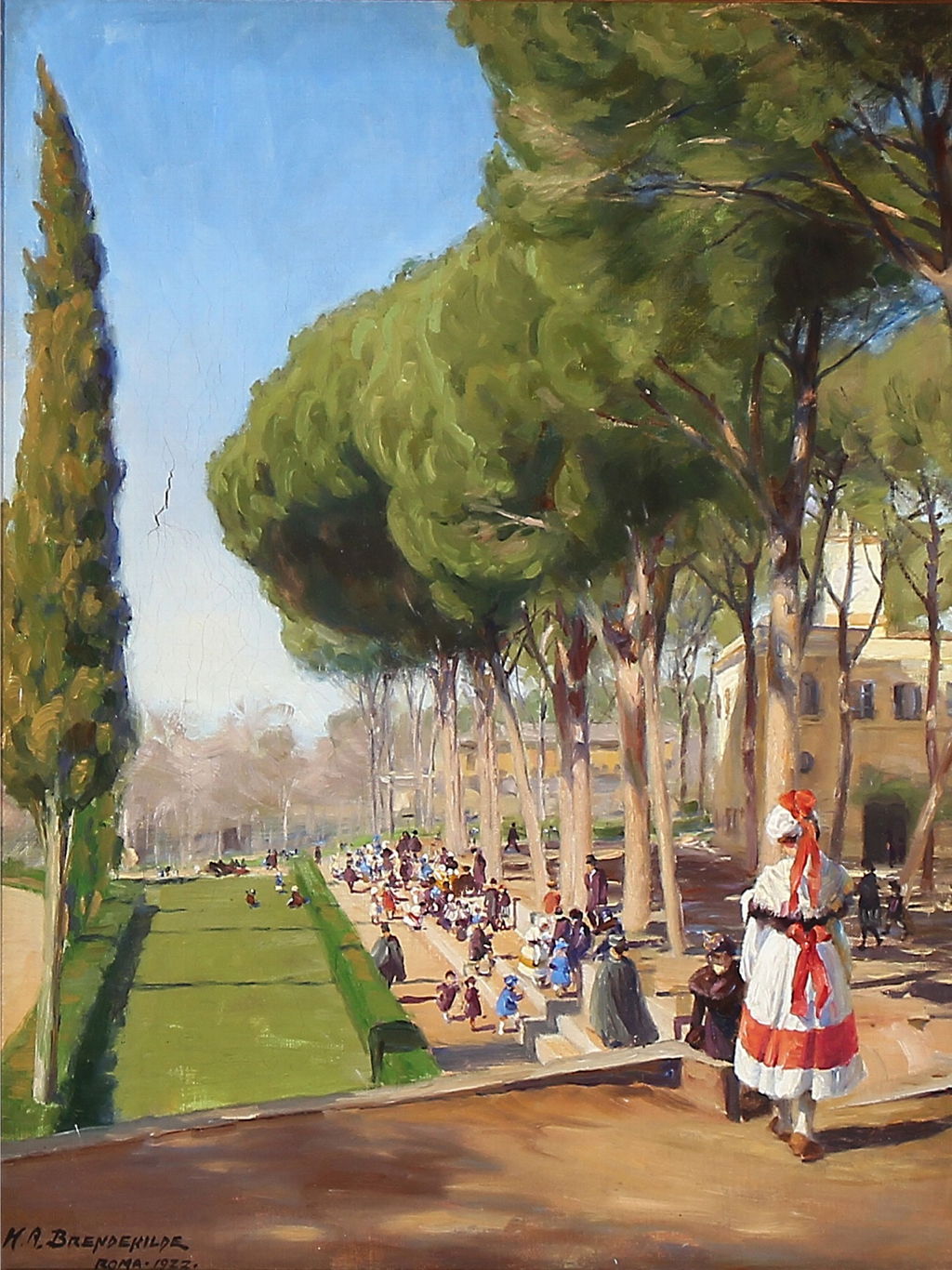
Hans Andersen Brendekilde painted this Summer Day in Villa Borghese in Rome late in his career, in 1922. It shows this large public park, which was originally landscaped in ‘English style’ from a former vineyard. It was bought by the city and made properly public in 1903, and has since hosted many events, including part of the 1960 Olympic Games.
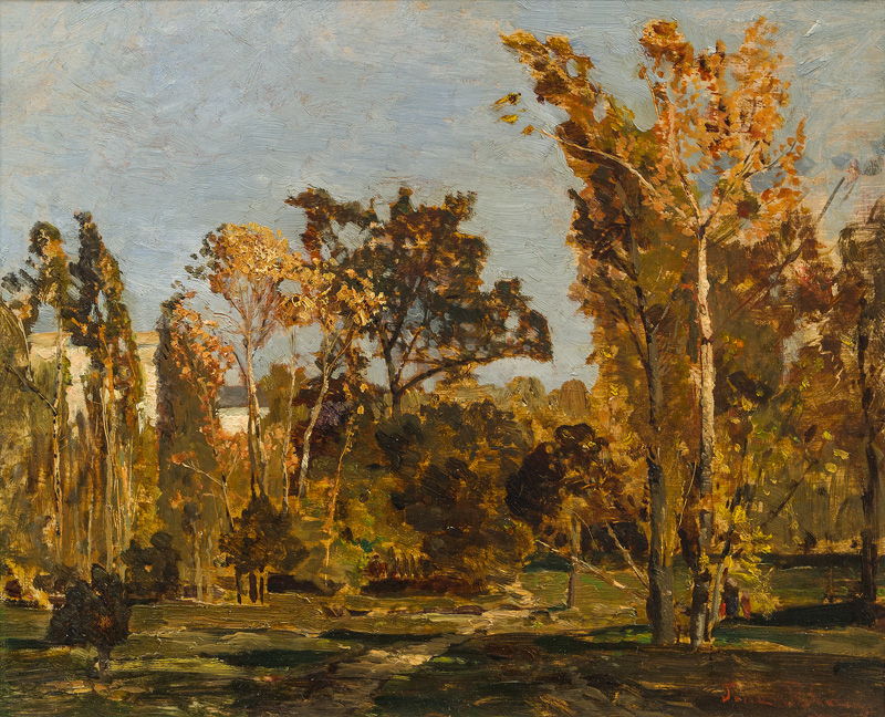
The Austrian Post-Impressionist landscape painter Tina Blau painted her favourite park, Vienna’s Prater Gardens, as its trees were just starting to change colour one autumn, probably around 1890. The Prater covers an area of 1,500 acres (600 hectares) and was opened to the public in 1766.
On the other side of the Atlantic, expansion of cities occurred slightly later, but preserved some notable parks.

This map of New York City and its environs in about 1885-90 shows Central Park on Manhattan Island and Prospect Park, then on the southern edge of Brooklyn.

William Merritt Chase’s view of Prospect Park, Park in Brooklyn from about 1887, shows housing at the edge. This now has an area of 526 acres (200 hectares), and was originally laid out by Frederick Law Olmsted and Calvert Vaux, and completed in 1873.

Olmsted and Vaux were also responsible for the first and most famous New York park of them all, Central Park, now 843 acres (341 hectares). Chase’s View from Central Park shows the park in 1889, and relegates the large buildings of Manhattan to its distant skyline.

Maurice Brazil Prendergast’s view of carriages in Central Park, 1900 (1900) shows how crowded it could become in fine weather.
These and many other views of urban parks have one feature in common: those who took advantage of them were seldom working class. Enjoying these small enclaves of countryside inside cities was almost exclusively for the middle class, who had the time and opportunity. There were also few such parks in industrial cities.
