
I thought you might enjoy this panorama (iPhone 6) taken in the unusually clear weather a few days ago.
This is a full view of the Isle of Wight, seen from the Worsley Obelisk on the southernmost downs on the Island.
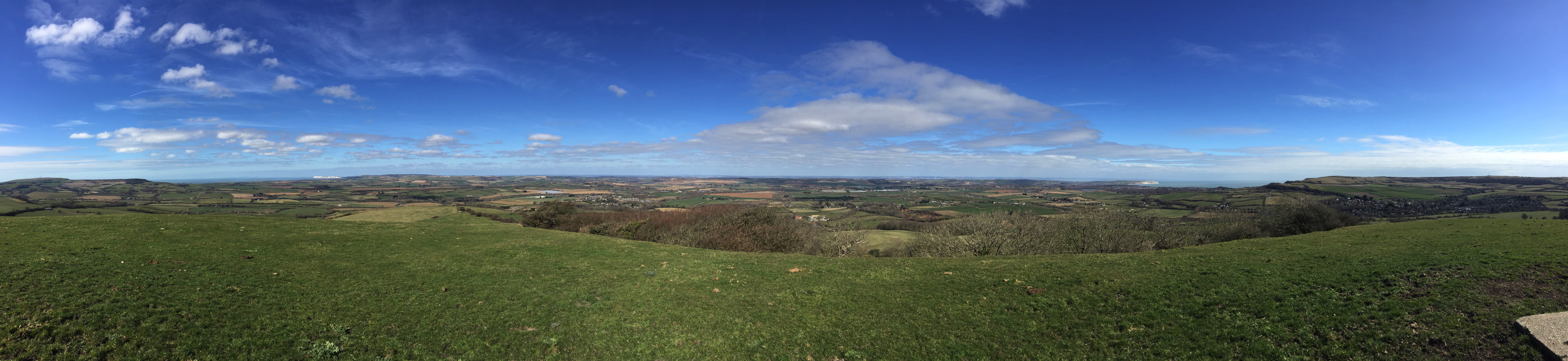
From the left:
- St Catherine’s Down (radio mast) below which (out of sight) is St Catherine’s Lighthouse
- Whitwell Village
- English Channel
- West Wight (wild country!)
- West High Down chalk cliffs, with the Needles at the extreme left
- Downs above Brook and Brighstone
- far distance – the New Forest (mainland)
- Godshill Village (nearest village to the north)
- far distance – Southampton (mainland)
- St George’s Down
- far distance – Eastern Solent, with Portsmouth (distinct by high white Spinnaker Tower, mainland)
- Arreton Valley (mid distance)
- Prominent white cliff of Culver Down, in front of which is Sandown Bay, with Sandown, Lake and Shanklin
- English Channel
- St Martin’s Down
- Wroxall Village (closest)
- St Boniface Down (radio mast).
We try to walk up to that obelisk daily, when the weather allows.
